An unincorporated village governed by county plans, not a city hall
Santa Margarita has no municipal government. The County of San Luis Obispo controls land use through the Land Use Ordinance and the Salinas River Area Plan, which includes the Santa Margarita Community Plan. It also uses the Santa Margarita Design Plan, which the Board of Supervisors adopted under Resolution 01-413. County code requires Minor Use Permit and Conditional Use Permit applications in the community to conform to the Design Plan. Its standards go down to fence materials visible from the street and height limits for multi-family buildings. Where the Design Plan conflicts with the Area Plan, the Design Plan prevails.
If you’re buying or selling, questions about remodels, additions and development go to County Planning and Building, not a city counter. Check the community plan’s combining designations parcel by parcel, including the Salinas River and creek flood-hazard areas. Verify current standards with the county.
The 14,000-acre ranch that frames the town
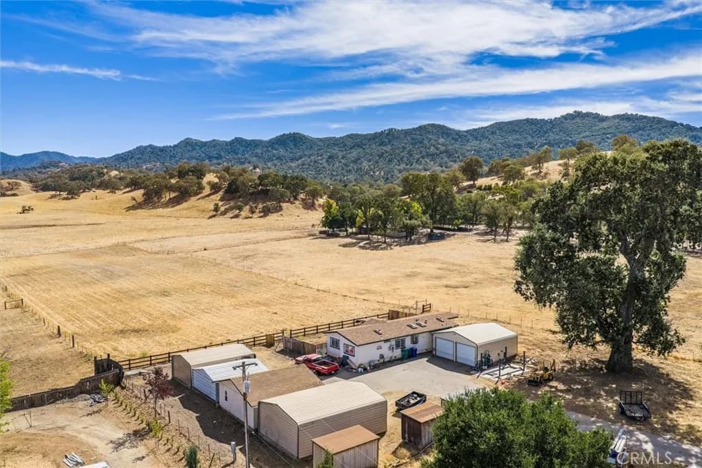
The village sits inside the historic Rancho Santa Margarita land grant. The surrounding Santa Margarita Ranch is still a private working ranch of roughly 14,000 acres, owned by three longtime local ranching and winegrowing families. The town exists because of the ranch. In 1889 Patrick Murphy sold the Southern Pacific a block of land at the ranch’s center. The railroad platted some 320 acres of lots and auctioned them that April, and that grid still stands today. The ranch also contains the Santa Margarita de Cortona Asistencia, a Mission San Luis Obispo outpost founded in the late 1700s and commonly dated to 1787. The county’s community plan designates it a state historic resource. It now operates as an event venue, with its original stone walls.
Since 2011 the ranch has built a substantial agritourism business. Margarita Adventures runs six ziplines spanning more than 7,500 feet, plus horseback, e-bike and nature tours. Ancient Peaks Winery grows its estate Margarita Vineyard on the ranch and has a tasting room downtown. The Christmas at the Ranch steam-train event has drawn seasonal visitors in recent years. The vineyard also gives the community its own appellation. Federal regulators approved the Santa Margarita Ranch American Viticultural Area (AVA) in October 2014, as the southernmost of the Paso Robles AVA’s eleven sub-appellations. For the housing market, the ranch works as a largely fixed rural boundary around the townsite.
Groundwater, County Service Area 23 and septic: the utilities picture
Water service in the townsite comes from County Service Area 23 (CSA 23), formed on July 27, 1999. It relies entirely on local groundwater, through two active wells and two storage tanks. A 2.5-mile emergency intertie pipeline along El Camino Real was completed in 2016. The county notes that drought conditions have historically affected availability. County technical studies have also flagged how close the primary well sits to the highway corridor and to the numerous individual septic systems in town. Those septic systems remain the common wastewater solution.
That combination sets your diligence list. Confirm whether a parcel is on CSA 23 water or a private well, and get the septic inspection and pumping records. For a rural parcel, look into the well’s production history. If you’re planning a more intensive use, ask County Public Works about service capacity early. Verify current status with the county.
Wildfire mapping and insurance on a county parcel
Wildfire isn’t an abstraction here. The Cuesta Fire started beside U.S. 101 on the grade in August 2015 and burned 2,446 acres of the Santa Lucia Range. It drew evacuation orders along Highway 58 south of the railroad tracks at Santa Margarita and out at Miller Flat. The town and the land immediately around it are State Responsibility Area. That puts wildland protection with the California Department of Forestry and Fire Protection (CAL FIRE). Structure response falls to the Santa Margarita Fire Protection District and its mutual-aid partners.
Hazard mapping is the part that reaches the transaction. Because this is State Responsibility Area land, its zones are the State Fire Marshal’s State Responsibility Area zones, in effect since April 1, 2024. The local-area maps the county adopted in 2025 don’t apply here. Designations turn on slope, fuel and exposure. A townsite lot and a parcel a mile up Pozo Road can land in different zones, so look up each address on CAL FIRE’s zone viewer. Public Resources Code 4291 reaches every structure here, whatever its zone. It requires 100 feet of defensible space or clearance to the property line. A high or very high designation adds a sale step under Civil Code section 1102.19. The law applies here because CAL FIRE takes inspection requests for State Responsibility Area homes. The seller can provide documentation of compliance obtained in the six months before the sale is agreed. Or the parties can sign an agreement that the buyer will obtain it within a year of closing. Coverage is the other half of the question. Insurers judge wildfire exposure with other risk tools rather than the state’s hazard map. The California FAIR Plan exists as the state’s last-resort fire policy when the open market declines to write one. If you’re buying, get insurance quotes early in escrow rather than late. Confirm a parcel’s current zone with CAL FIRE.
Santa Margarita Lake: a reservoir first, a park second
Santa Margarita Lake, also called Salinas Reservoir, was created by the Salinas Dam. The War Department built the dam in 1941 to supply Camp San Luis Obispo. Today the lake stores drinking water for the City of San Luis Obispo, delivered through a mile-long tunnel under the Cuesta Ridge. Because it’s a domestic supply reservoir, body contact is prohibited, including swimming and waterskiing. The county-operated recreation area still supports boating, well-regarded fishing, 60 primitive campsites plus boat-in sites and a seasonal pool. It also has a natural area of several thousand acres, open to hikers, cyclists and equestrians.
Rules change. Effective January 2026, the county imposed a 30-day quarantine requirement for ballast-equipped boats at Santa Margarita and Lopez lakes, to block invasive mussels. If you plan to use a boat, check SLO County Parks for current access and inspection requirements first.
Gateway to the Carrizo Plain and the Highway 58 backcountry
The Bureau of Land Management (BLM) formally lists Santa Margarita as a gateway community for the Carrizo Plain National Monument, with visitor information posted on El Camino Real. Wikipedia describes the Carrizo Plain as the largest remaining native grassland in California. Highway 58 begins at U.S. 101 in the middle of town and runs east into the La Panza backcountry. It reaches the monument’s northern entrance at Soda Lake Road, and Pozo Road branches off it toward Santa Margarita Lake and Pozo. The BLM stresses that the monument itself has no food, fuel or water services. That’s what makes the gateway role real.
If you live here, the same road network means uncommon access to public-land recreation, from the county lake park to wildflower season at the monument. You get it without the coastal traffic patterns of the county’s beach towns. If you’re selling, the durable fact to market is position. The town is the last services stop between U.S. 101 and one of California’s most remote protected landscapes.
Vacation rentals under the county’s inland rules
Because Santa Margarita is unincorporated, short-term rentals follow San Luis Obispo County’s Vacation Rental Ordinance, not a city program. Renting an entire residence for under 30 days requires a zoning clearance from County Planning and Building. It also requires a county business license, with transient occupancy tax registration through the Tax Collector. The county applies operational standards too, covering matters like occupancy and parking. It keeps separate application tracks for the inland area and the Coastal Zone, and Santa Margarita falls under the inland process.
The county actively manages the program. The Board of Supervisors approved an annual review fee for all short-term rentals starting January 2026, citing a countywide registry that has grown past two thousand licenses. If you’re buying for rental income, verify parcel eligibility, current standards and fees with the county before you underwrite it.