Why Hermosa students choose between two high schools
Hermosa Beach has no high school of its own, and that’s by design. Until the early 1990s, the three beach cities’ elementary districts sat within a shared South Bay Union High School District. In November 1992, voters in Hermosa Beach, Manhattan Beach and Redondo Beach, voting together, approved Proposition V, the split unification plan, with 59.1% of the vote. It dissolved that high school district so Manhattan Beach and Redondo Beach could form their own K-12 unified districts.
The Hermosa Beach City School District stayed an elementary district. The California Department of Education calls the state’s law on the reorganization, AB 325 (Chapter 24 of the Statutes of 1992), special legislation. It lets high school students living within the district’s boundaries attend either the Manhattan Beach or the Redondo Beach unified district. So after eighth grade at Hermosa Valley School, students choose between Mira Costa High School and Redondo Union High School.
The district itself runs a preschool at the Hermosa View campus. Hermosa View School serves transitional kindergarten and first grade. Hermosa Vista School serves grades two through four, and Hermosa Valley School grades five through eight.
Short-term rentals after the 2026 judgment and ordinance
On May 24, 2016, the City Council adopted an ordinance prohibiting rentals of fewer than 30 consecutive days in every residential zone. The ban was challenged in Koerner v. City of Hermosa Beach. After a tentative ruling in late March 2026, the Los Angeles County Superior Court entered judgment on April 23, 2026. As the City describes it, the judgment held the prohibition unenforceable within the coastal zone because the City hadn’t obtained Coastal Commission approval for it. The City says short-term rentals may therefore operate there unless and until it adopts further coastal-zone rules and obtains any approval the Commission requires. On May 12, 2026, the Council voted 4-1 in closed session not to appeal.
The Council then set rules for the coastal zone. On September 8, 2026, it adopted Ordinance 26-1502 by a 3-2 vote, to take effect 30 days after adoption. The ordinance allows short-term rentals inside the coastal zone and prohibits them outside it. It repeals the permit-based pilot that had allowed a few rentals in commercial zones. As presented for adoption, it requires each coastal-zone operator to register through the City’s online platform, with owner contact details and a local emergency contact available around the clock. Operators must also hold a City business license and pay the transient occupancy tax, which the code sets at 14% of the rent. Violations are punishable by administrative citation. The Council directed that the program come back for review after six months. At the same meeting, a request that the Planning Commission develop a permanent short-term rental program didn’t win the majority support needed to proceed.
City staff reported that additional land-use rules for coastal-zone rentals may require Coastal Commission approval. In December 2016, the Commission told coastal cities it doesn’t believe outright vacation-rental bans adopted outside a Local Coastal Program or coastal development permit are enforceable in the coastal zone.
If you’re looking at a property as a rental, the answer for any particular address turns mainly on two things. One is which side of the coastal zone line it sits on, which the City’s zoning map shows. The other is the kind of unit. The City’s code separately bars renting an accessory dwelling unit, junior unit or home on an SB 9 lot for less than 30 days.
The 2015 vote that kept oil drilling out of Hermosa Beach
On March 3, 2015, Hermosa Beach voters rejected Measure O by 5,968 votes to 1,538, according to the City Clerk’s certified canvass. The measure would have approved E&B Natural Resources Management Corporation’s oil drilling and production project at the City’s maintenance yard at 555 Sixth Street. It called for 30 production wells and four water injection wells. The measure would also have exempted the project from the City’s ban on oil drilling.
The vote grew out of a long legal fight. The City had leased the yard to Macpherson Oil Company in 1992 for drilling. In 1995, voters adopted Proposition E, an initiative prohibiting oil drilling in the city. After the City halted the project, Macpherson sued. A 2012 settlement ended that suit. E&B took over Macpherson’s rights, and its project went to the voters. Defeating Measure O left the City obligated to reimburse E&B under that deal. According to the City’s audited financial report, the City and E&B settled again in March 2017. That settlement permanently ended E&B’s drilling and mineral rights in the city, the Measure O project included. The municipal code still declares the drilling of an oil or gas well in the city a nuisance and unlawful.
How the general plan and zoning shape what gets built
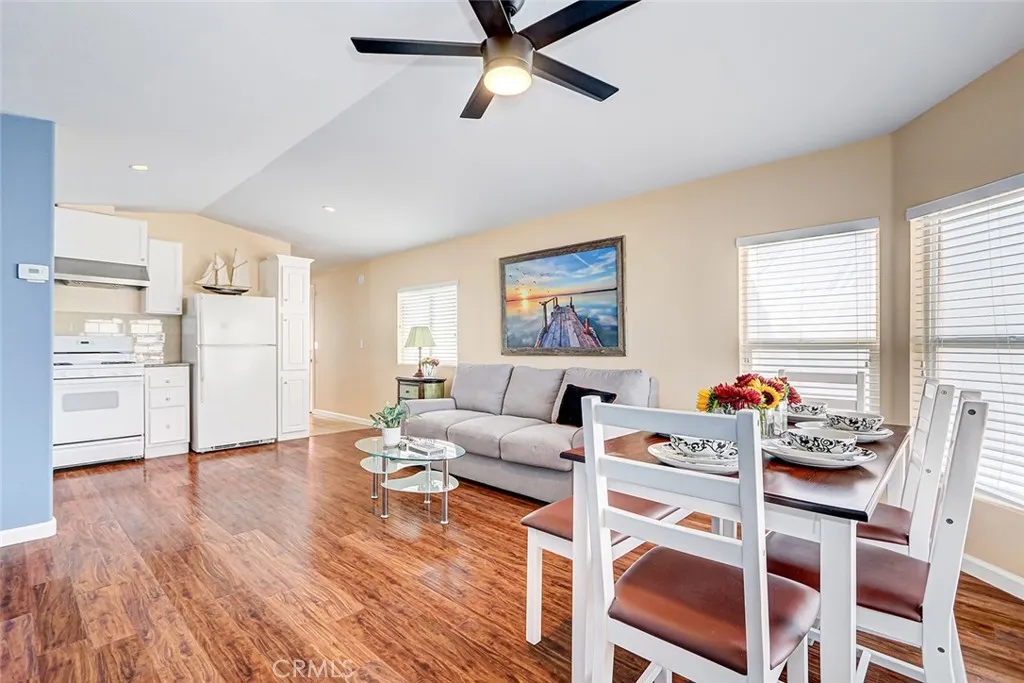
Hermosa Beach had roughly 13,800 residents per square mile at the 2020 census. PLAN Hermosa, its general plan, explains much of the housing mix you’ll see. Low-density areas allow about 2 to 13 dwelling units per acre and are meant to retain single-family neighborhoods. The medium-density designation, at 13.1 to 25 units per acre, permits owners to build two units on a single lot. The plan names its predominant uses as single-family homes, duplexes, condominiums and townhouses in a two-unit-per-lot format. High-density areas allow up to 33 units per acre. The Mobile Home designation covers a single property. It keeps the Marine Land Mobile Home Park for mobile homes as an affordable housing option.
The zoning code carries the specific standards for each zone, including the lot area each unit requires. The R-1A zone allows at most two units, with at least 3,350 square feet of lot for each. R-2 requires 1,750 square feet of lot per unit, and an existing R-2 lot narrower than 30 feet may hold only a single-family home. R-2B allows a two-family dwelling on a lot. R-3 requires 1,320 square feet of lot per unit. Where a number follows the zone symbol on the zoning map, it replaces the chapter’s figure. The plan says its land use designations and the zoning districts must be compatible but don’t have to be the same. So if you’re comparing two nearby lots, check both.
The coastal zone line, and who issues the coastal permit
The California coastal zone takes in roughly the western part of Hermosa Beach. The City puts it at about 43% of its land, reaching from the mean high tide line inland to Ardmore Avenue. Two pockets are left out. One runs from Hermosa Avenue to Valley Drive between Longfellow Avenue and 31st Place. The other lies east of Park Avenue or Loma Drive between 16th and 25th Streets. Other passages of the City’s general plan put the share at about half. For much of the city, the Coastal Commission’s own boundary line follows the former Santa Fe railroad right-of-way, the corridor the Greenbelt now occupies. If you’re checking a specific lot, the City’s zoning map shows the boundary, along with the band within 300 feet of the beach.
The Coastal Commission, not the City, issues coastal development permits in Hermosa Beach. The Commission certified the City’s Land Use Plan, effective April 21, 1982. But the implementing ordinances the City later submitted were withdrawn before a 2001 hearing. So the City has never had a complete Local Coastal Program certified. Commission staff reports as recent as March 2026 apply the Coastal Act, with the 1982 plan as guidance. Since July 23, 2026, the City’s code has also required a City Coastal Clearance for all development in the zone. Before the City issues its own permit, the applicant must show a Commission approval, waiver or exemption. City staff check it against the City’s approval in concept.
State law sets which projects need a coastal permit. The Coastal Act requires one for “development”. That term covers construction, demolition, a change in the size of a structure, lot splits and any change in the density or intensity of use of land. Improvements to an existing single-family home are exempt, except for classes the Commission’s regulations name. One class is work on a beach or within 50 feet of a coastal bluff edge. Another covers property between the sea and the first public road paralleling it, or within 300 feet of the beach. There, an addition of 10% or more of floor area or a height increase of more than 10% needs a permit. Replacing half or more of a single-family house, unless a natural disaster destroyed it, counts as a new structure that needs a permit. The City’s own guidance adds that a site where a coastal permit was issued before may need one for later work.
Height, lot coverage and parking: the limits on a remodel or rebuild
Hermosa Beach limits the size of a house through height, lot coverage, yards and open space. Its residential zone chapters set no floor-area ratio, though a Class 2 accessory dwelling unit may not push a lot’s total floor-area ratio above 50%. Buildings may reach 25 feet in the R-1 single-family and R-1A zones and 30 feet in the R-2, R-2A, R-2B, R-3 and R-P zones. In R-3 and R-P, the Planning Commission may allow up to 35 feet, but only after a public hearing and only when every listed condition is met. One of them is that the extra height will not adversely affect the views, sunlight and air of surrounding properties. Height is measured from grade to the top of the roof, with grade set from a certified survey of the lot’s corner elevations. It’s checked by survey at the framing stage. In the residential zones, the only roof structures allowed above the limit are chimneys, vents and flues. Even those may go only as far as the building code requires. Solar panels, some antennas and up to two roof-deck umbrellas have limited exceptions of their own.
In the R-1, R-1A, R-2, R-2A, R-2B and R-3 zones, all buildings on a lot, accessory buildings included, may cover no more than 65% of it. An R-1 lot of 2,100 square feet or less may be covered to 70%, and so may an R-P lot. R-1 requires 400 square feet of usable open space on a standard lot and 300 on those small lots. R-1A requires 400 square feet per unit. R-2, R-2A, R-2B and R-3 require 300 square feet per unit, up to 100 of which may be on a roof deck.
Parking shapes many remodels. A single-family home needs two off-street spaces plus one guest space. A duplex needs two spaces per unit plus a guest space. Required spaces may be tandem, but only in R-1 may tandem parking open directly onto a street. An alteration that changes a building’s floor area by more than 10% or 500 square feet, whichever is greater, must add parking under the chapter’s standards. On a site with one or two units that has fewer than two conforming spaces per unit, additions are capped. Where there’s less than one space per unit, the cap is 100 square feet, or 500 if a space is added. Where there are one or more but fewer than two spaces per unit, it’s 500 square feet. A site short only of its guest space may expand as the rules for nonconforming buildings allow. A site with three or more units may not add floor area unless it provides two spaces per unit and one guest space for every two units.
Buildings that no longer meet today’s standards have their own rules. A nonconforming building may grow by up to 100% of the floor area it had before October 26, 1989. It can’t grow beyond 3,000 square feet per unit or 5,000 square feet per site. A building with more units than the zone’s lot-area rules now allow counts as a nonconforming use instead. It may grow by only 50%, and not at all where its density exceeds 45 units per acre. In a nonconforming building, conforming parts may be removed and replaced only while the foundation and floor system remain. A nonconforming part, such as a wall inside a required yard, must be rebuilt to current rules if it’s completely removed. If fire or another casualty the owner didn’t intentionally cause damages a nonconforming home, it may be restored if it meets the code’s conditions. Among them, no nonconformity may increase and the home may stand no more than 20% above the zone’s height limit.
The zoning code has no general private-view protection. Views enter as one test among others. Examples are the 35-foot exception in R-3 and R-P and the permit for an over-height wall or fence between a business and a home. The design standards for new condominiums also require consideration of a project’s effect on the light, air, view and privacy of neighboring properties. Review depends on the project. A single-family house, an accessory dwelling unit or an addition under 1,500 square feet needs no Precise Development Plan. Two to four units need a minor plan, decided by the Community Development Director after public notice. Five or more need a major plan, heard by the Planning Commission. Ordinance 26-1500 rewrote those procedures without amending the residential zone standards. The City adopted it on June 23, 2026, as part of a comprehensive zoning code update it began in 2020.
Adding a unit: ADUs, junior ADUs and SB 9
Every accessory dwelling unit (ADU) and junior accessory dwelling unit (JADU) in Hermosa Beach needs an ADU permit and a building permit. Both are ministerial, decided without discretionary review or a hearing. The City must say within 15 business days whether an application is complete. With narrow exceptions, a complete application it doesn’t act on within 60 days is deemed approved.
The code sorts units into two classes. Class 1 covers the combinations state law protects. On a single-family lot, it allows one ADU and one JADU within the space of the house (or, for the ADU, of an existing accessory structure). Together with those, it allows one new detached ADU of up to 800 square feet, with side and rear setbacks of at least four feet. On a multifamily lot, it allows converted units in space not used for living and a limited number of detached ones. Every other ADU is Class 2. A Class 2 unit is capped at 850 square feet for a studio or one-bedroom and 1,000 for two or more bedrooms. It needs four-foot side and rear setbacks and a 25-foot front setback. It also needs one parking space for each ADU or bedroom, whichever is less, unless an exemption applies, such as a site within half a mile’s walk of public transit. The percentage, floor-area, front-setback, lot-coverage and open-space limits may not force a Class 2 ADU below 800 square feet.
A detached ADU may be 16 feet tall. It may be 18 feet within half a mile’s walk of a major transit stop or high-quality transit corridor (up to 20 to match the house’s roof pitch). It may also be 18 feet on a lot with a multistory multifamily building. An attached ADU may be 25 feet or the zone’s limit, whichever is lower. No ADU or JADU may be rented for less than 30 days, whenever it was built. None may be sold apart from the lot and the main house, except under a narrow state exception for affordable units developed by qualified nonprofits. ADUs carry no owner-occupancy requirement. A JADU does, unless it has its own sanitation facilities or a public agency, land trust or housing organization owns the property. The Coastal Act still applies. Where an ADU needs a coastal development permit, the ADU application isn’t complete until it includes a complete coastal permit application. In Hermosa Beach, coastal permits come from the Coastal Commission. The City’s 2025 ADU handout adds that replacement parking may be required in the coastal zone when a garage is converted.
If you own a lot in the R-1 zone, the state’s Senate Bill 9 (SB 9) lets you build a two-unit project, two primary homes on one lot. It also lets you split the lot in two. The City decides both ministerially, and only individual owners may apply. A split needs a lot of at least 2,400 square feet. Each new lot must be at least 1,200 square feet and 40 to 60% of the original. The split also needs an affidavit that the applicant will live in one of the units as a principal residence for at least three years. A lot created by a split may hold no more than two dwellings of any kind. Each new primary dwelling in a two-unit project must be at least 800 square feet. It needs a parking space unless the lot is within half a mile’s walk of qualifying transit or a block of a car-share location. Neither a split nor a two-unit project may demolish income-restricted or rent-controlled housing, or housing occupied by a tenant in the past three years. No unit may be rented for less than 30 days. Both chapters of the City’s code say the Coastal Act applies in full. So a project in the coastal zone may also need a coastal development permit. State law excuses only the local agency from holding a public hearing on it. In Hermosa Beach, the Coastal Commission, not the City, issues coastal permits.
Tsunami, flood, liquefaction and sea-level rise: what the maps show
Hermosa Beach’s mapped natural hazards sit mostly along the shore. The state’s Tsunami Hazard Area map for Los Angeles County, dated March 22, 2021, covers the beach, The Strand and the blocks out to about Hermosa Avenue. The City’s general plan says its inundation line runs parallel with Hermosa Avenue. The map was prepared for tsunami response planning, and it says it doesn’t meet disclosure requirements for real estate transactions. The general plan calls the probability of a tsunami extremely low. The City’s 2025 hazard mitigation plan rates a catastrophic tsunami possible, at between 1 in 100 and 1 in 1,000 a year. It also records no tsunami ever having struck the city. Flood maps from the Federal Emergency Management Agency (FEMA), effective April 21, 2021, put the special flood hazard area on the beach itself, stopping at The Strand. The rest of the city is in Zone X. The hazard plan says no private development lies in a special flood hazard area.
The state’s seismic hazard maps, released in 1999, add a liquefaction zone over most of the same band, from the sand to about Hermosa Avenue. The zone also covers a small area along 2nd Street between Monterey Boulevard and Valley Drive. The general plan also names that area as sitting on soils susceptible to liquefaction. The same state maps mark four small earthquake-induced landslide zones. The plan limits the city’s landslide hazards to four places. They’re along the eastern city limit between 7th Place and 8th Street, above Gould Terrace, in part of South Park and on properties south of the park on Culper Court. No earthquake fault zone lies within 5 kilometers of the city. The plan says the city has no known active faults and no area subject to dam-failure inundation. The state’s Natural Hazard Disclosure Statement asks about six kinds of area. They’re a special flood hazard area, dam-failure inundation, a high or very high fire hazard severity zone, a wildland fire area, an earthquake fault zone and a seismic hazard zone.
Sea-level rise is a longer-range question, and the City’s studies describe it scenario by scenario. A 2014 assessment for the City mapped a 100-year flood on top of 55 inches of sea-level rise. In that scenario, the flood zone roughly tripled, from 0.034 to 0.1 square miles. It reached inland from The Strand to Hermosa Avenue, mainly in the central and southern city. It took in 143 residential buildings, where the 100-year flood without sea-level rise reached none.
A 2016 study of City infrastructure tested 2 feet of rise by 2050 and 5.48 feet by 2100. Under those scenarios, about 21 and then 50 sewer segments would sit partly or fully in groundwater, all within 700 feet of The Strand.
A January 2023 City summary of a later study found the city generally not at immediate risk from forecast flooding. That’s largely because its beaches, 275 to 550 feet wide, would remain 175 to 450 feet wide even with 6.7 feet of rise. That figure is the study’s medium-high-risk projection for 2080. The summary cautioned that unusually high rainfall and exceptionally high tides together could cause significant flooding at any time. It named Hermosa Avenue from Herondo Street to 4th Street as the studied site with the greatest flood risk. In May 2026, the City Council contracted for a new vulnerability assessment and sea-level rise adaptation plan.
Who provides services, and what the tax bill carries
Hermosa Beach runs its own police department. Its station at 540 Pier Avenue is open around the clock. Fire protection and emergency medical service have come from the Los Angeles County Fire Department since December 30, 2017. That service began after the county’s Local Agency Formation Commission annexed the whole city to the Consolidated Fire Protection District. Hermosa Beach is a fee-for-service city, paying the district an annual fee. It isn’t among the cities whose parcels carry the district’s 1997 special tax. County Fire Station 100 shares the Pier Avenue address. Ambulance transport comes from McCormick Ambulance under a City contract. The City lists Los Angeles County Lifeguards, with a Hermosa Beach lifeguard headquarters at 1201 The Strand.
California Water Service supplies water through its Rancho Dominguez District. Southern California Edison delivers electricity. Clean Power Alliance has been the default supplier since March 2024, unless a customer opts out. Southern California Gas supplies gas, and Athens Services collects trash and recycling. The City owns the sewer mains and funds their upkeep through a sewer service charge on the property tax bill. If you own property here, you’re responsible for the lateral from it to the main.
The tax bill also carries the Hermosa Beach Landscaping and Street Lighting District assessment, charged per dwelling unit. On streets that formed an undergrounding district, it carries installments on any assessment not paid off in cash. Those installments stay with the parcel until the district’s bonds mature. The Hermosa Beach City School District doesn’t appear on the County’s list of school districts placing a parcel tax on the property tax bill.