From Los Angeles County’s first port to King Harbor
Redondo Beach began as a shipping and resort town. The Hotel Redondo opened in 1890. The City’s history says Redondo was then the first port of Los Angeles County. Pacific Steamship Company vessels stopped four times a week at one of its three piers, on runs between San Francisco and San Diego. The Redondo Railway and the Santa Fe ran trains daily from Los Angeles. Together the railroads and steamships brought people by the thousands, along with freight. Voters adopted cityhood on April 18, 1892, by a vote of 177 to 10. The town’s popularity began a slow decline once San Pedro’s harbor started to take shape in 1899. By 1912 the steamship line had stopped calling altogether.
Storms shaped the modern waterfront. Redondo’s first breakwater, built in 1939, gave only limited protection and changed how sand moved along the beach. A 1953 storm damaged the breakwater along with streets and private property. In 1956 work began on King Harbor, named for Representative Cecil R. King. The pier went through its own cycle of storms and rebuilding. Two storms and a fire damaged it in 1988, and the current pier was unveiled in 1995.
North Redondo and South Redondo: how the city splits
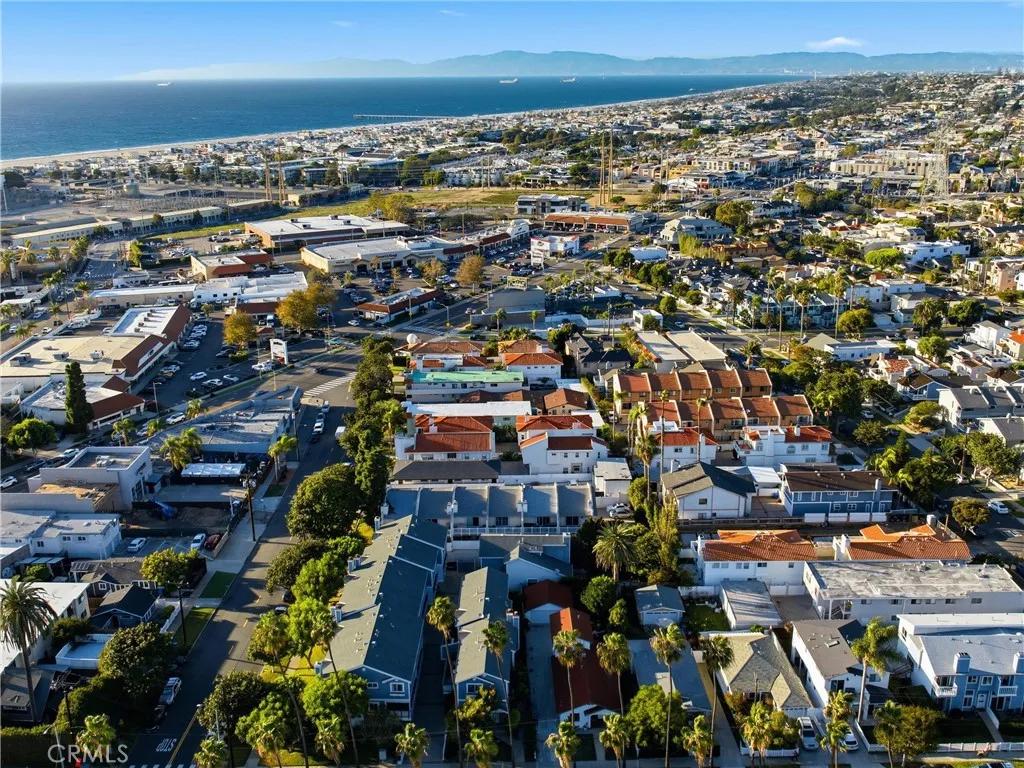
Redondo Beach has a coastal southern half and an inland northern half. Its two ZIP code tabulation areas divide it the same way, with 90277 in the south and 90278 in the north. The school district’s campuses fall on either side. Birney, Jefferson, Lincoln, Madison and Washington elementary schools and Adams Middle School are in the north. Alta Vista, Beryl Heights and Tulita elementary schools, Parras Middle School and Redondo Union High School are in the south. The beach, the pier, King Harbor and Riviera Village are in the south too. North Redondo holds the South Bay Galleria and Redondo Beach station, the K Line’s southern terminus.
School assignment doesn’t follow that line exactly. Redondo Beach Unified assigns each home a school of residence through its online School Locator. The locator holds separate elementary, middle and high school boundaries. The page the district titles School Boundary Maps shows only the district’s outline. Adams Middle School’s course-selection page addresses incoming sixth graders from Birney, Lincoln, Madison and Washington. But addresses tested in the School Locator in the Jefferson area were assigned to Parras. So part of North Redondo goes to the southern middle school. Redondo Union is the district’s only comprehensive high school. High school students in two defined parts of North Redondo may apply for an inter-district release to attend Mira Costa High School, which both districts must approve. Board policy also lets the superintendent place some students at a school outside their attendance area to relieve overcrowding. To see the schools assigned to a specific address, enter it in the School Locator.
What the housing stock looks like, and why two- and three-unit townhomes are everywhere
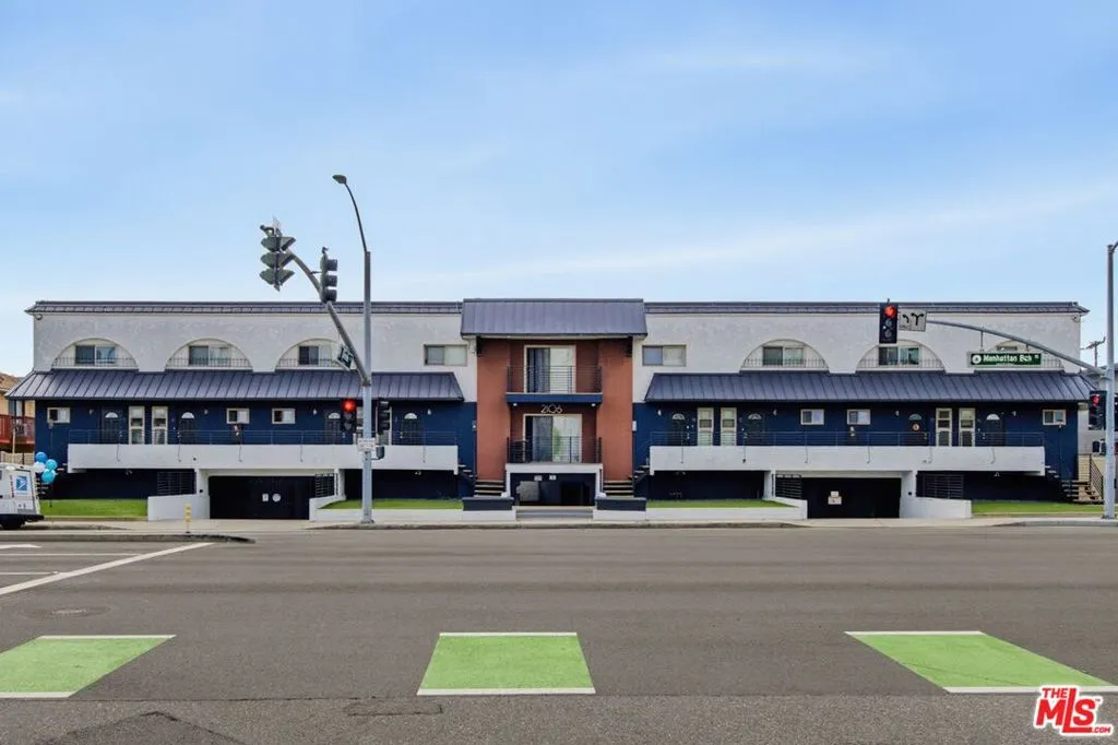
Redondo Beach is a built-out city, and the Land Use Element the City adopted on August 4, 2026 describes the result. About 40% of the city’s residential land is designated for single-family homes and 60% for multifamily housing. Single-family homes make up about 54% of the housing stock and multifamily homes about 46%, with mobile homes under 1%. More than two-thirds of the stock was built before 1980. The 2021-2029 Housing Element breaks the stock down further, from 2015-2019 Census estimates: 41% detached single-family homes, 14% attached single-family homes such as townhomes, 13% in buildings of two to four units and 31% in buildings of five or more. About half of occupied homes were owner-occupied in 2019. The element notes that developers in the 1970s and 1980s built condominiums and townhomes, rented them until the construction-defect limitations period had run, and then sold them. It also notes that a condominium is a form of ownership rather than a building type, and that townhomes are a form of condominium.
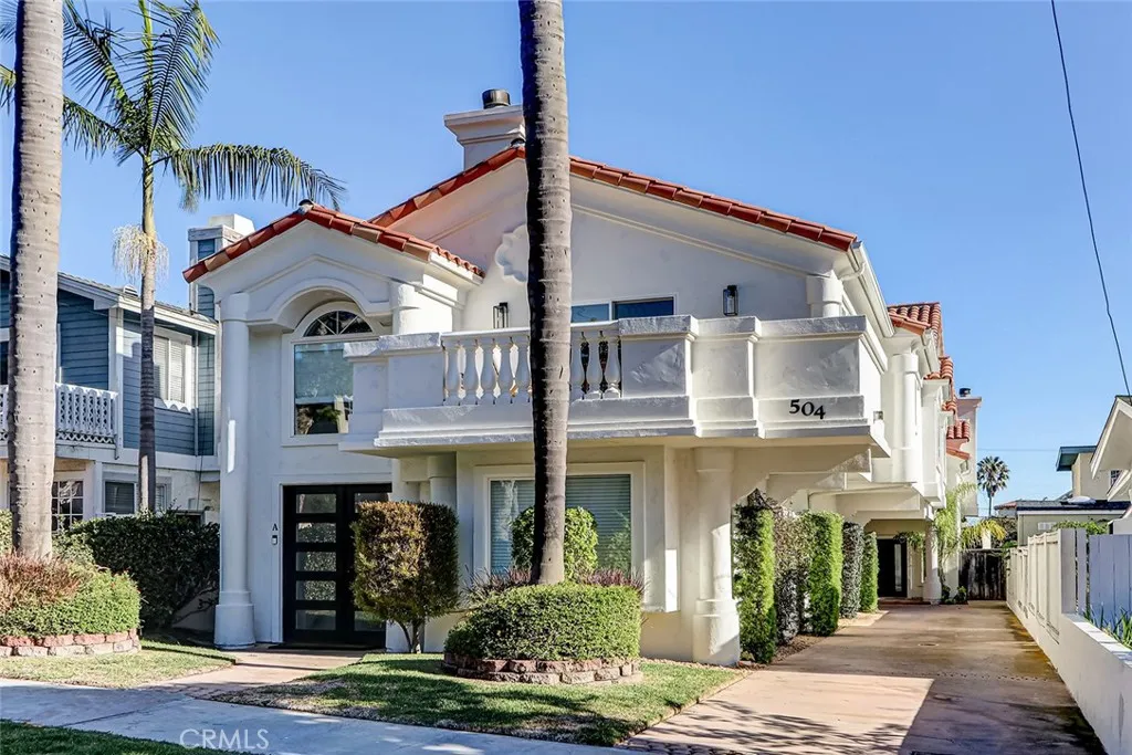
The pattern a buyer meets most often is the small condominium project. The Housing Element says the typical new residential development recycles a single-family lot in the R-2 or R-3 zone into a condominium project of two or three units. It counts 41 such projects approved in 2017, 24 in 2018, 25 of two to four units in 2019 and 10 in 2020. Projects of two or three units go through staff-level Administrative Design Review, plus a tentative parcel map if the units are condominiums. Four or more units need a Planning Commission hearing. On the City’s zoning layer, R-2 covers about 470 acres and R-3 about 440. About 97% of the R-2 land and about 57% of the R-3 land lie in the 90278 area, North Redondo, which is why the two- and three-unit townhome is so much a North Redondo type. The R-1A single-family zone is entirely in North Redondo. The coastal R-3A and RH zones are entirely in South Redondo, and so is most of the RMD zoning. R-1 splits almost evenly between the halves. In the General Plan, R-2 allows up to 14.6 homes per acre, R-3 up to 17.5, RMD up to 23.3 and RH up to 30.
The coastal strip: Pacific Coast Highway to the sea
In Redondo Beach, the inland edge of the California coastal zone follows Pacific Coast Highway for about 2.6 miles. It runs from the Torrance line north to the former power plant. There, a short stretch along a property line takes it west to the Hermosa Beach border. Everything between that line and the ocean is in the zone. That’s about 660 acres, a sixth of the city’s land, nearly all of it in South Redondo. It takes in the beach, the pier, King Harbor, Riviera Village and the power plant site. Most of its residential land is zoned for multifamily use. Virtually all of the city’s R-3A land lies inside it, as does about half of the RMD land and some single-family blocks toward the southern end. The coastal zoning chapter of the municipal code applies to all land in the zone.
The Coastal Commission has certified the City’s Local Coastal Program, so the City issues coastal development permits itself. Inside the zone, nearly any development needs one. The code’s definition covers construction, demolition, reconstruction, a change in a building’s size, lot splits and grading. Improvements to an existing single-family house are generally exempt. But you first apply to the Community Development Director for an exemption determination. The exemption has exceptions. Among others, it doesn’t cover work that adds a dwelling unit, unless it’s an accessory unit built inside the existing living area without replacing roofs, exterior walls or foundations. It also doesn’t cover work within 50 feet of a bluff edge, on a beach or in a wetland or sensitive habitat. Nor does it cover work on a home whose original coastal permit says later additions need one. Stricter limits apply between the sea and the first public road parallel to it, or within 300 feet of the inland edge of the beach, whichever is farther. There the exemption also excludes adding 10% or more to the internal floor area, or making a further addition after an earlier exempt one. It excludes adding a story or loft, raising the height by more than 10% and building a significant detached structure. Replacing half or more of a house isn’t treated as exempt repair unless a natural disaster destroyed it.
The coastal chapter has its own rules for older and damaged buildings. One covers a building that no longer meets its zone’s standards. The code counts all demolition and reconstruction on it since the Local Coastal Program was certified. If that work replaces more than half of the building, it’s allowed only if the building is brought into conformance. A single-family home destroyed by disaster is the exception. It may be rebuilt for the same use, in the same place, no more than 10% larger and with no increase in its nonconformity. Any structure destroyed by a natural disaster can be replaced without a coastal permit only if it meets four conditions. The replacement must conform to current zoning, serve the same use, stand in the same place and be no more than 10% larger in floor area, height or bulk. Other permits still apply.
In the appealable area, a City Council approval can be appealed to the Coastal Commission once local appeals are used up. That area includes land between the sea and the first public road, or within 300 feet of the beach, whichever is farther. Decisions of the Community Development Director can be appealed only to the Planning Commission. Where the City waives the hearing on a minor project, a person who didn’t ask for one may lose the chance to appeal to the Commission. Permit applications for development on tidelands and public trust lands are referred to the Commission, with some exceptions. A 2025 Commission staff report says development in King Harbor is within its permit jurisdiction.
Height, floor area and older homes
The zoning code sets the building envelope zone by zone. The two chapters share several residential zones, and for those the height and floor-area limits are the same in both. The coastal chapter states its density limits in units per net acre. In R-1, the single-family zone, a lot takes one house of up to 30 feet and two stories. All buildings on the lot, garages included, may reach a floor area of 0.65 times the lot area. A menu of design choices can raise that to 0.8. The choices include a roofed front porch, a garage at the rear of the lot or a wider second-floor side setback. The front setback averages 25% of the lot’s depth or 25 feet, whichever is less. It never falls below 20 feet. The second story sets back another 10 feet on average. Side setbacks are 5 feet, with exceptions for additions on narrower lots. The rear yard averages 20% of the depth and is never less than 15 feet. Height is measured from existing grade along a line across the middle of the lot. A raised floor can make the space beneath it count as a story. R-1A is a single-family zone found only in the inland code. It also allows 30 feet and two stories. Its front setback is at least 25 feet, and its side setbacks are 3 feet or 10% of the lot’s width, whichever is greater. Its rear setback averages 16 feet, and it states no floor area ratio. The multifamily zones R-2, R-3, R-3A, RMD and RH-1 also stop at 30 feet and two stories. RH-2 and RH-3 allow 35 feet and three stories, and RH-3 allows up to 45 feet with a density bonus for low- and moderate-income housing. RH-4, an inland zone added in June 2026, allows 55 feet and five stories, or more with an affordable housing benefit. Every single-family home needs a two-car enclosed garage.
A home that no longer meets its zone’s standards may remain and be structurally altered. An addition must meet current standards and can’t increase the nonconformity. The Community Development Director can, though, let some additions go ahead without the full parking requirement. Outside the coastal zone, a nonconforming building destroyed to the extent of half or more of its floor area must be rebuilt to current code, with two exceptions. Apartments and condominiums may be rebuilt to their original number and size of units. A single-family home lost to an involuntary event may return to its former setbacks and size, as long as the nonconformity doesn’t increase. The inland code doesn’t address a voluntary teardown in those words. Inside the coastal zone, the cumulative rule described in the coastal zone section applies.
New houses, additions of more than 500 square feet and any addition above the first floor go through Administrative Design Review. That’s a staff-level check that applies the City’s Objective Residential Standards. The zoning code requires no notice of a pending design review decision on a single-family project. For such projects, only the applicant or owner may appeal the decision to the Planning Commission. Where a coastal development permit is also needed, the City mails notice of it to owners and residents within 100 feet.
Accessory units, and SB 9 in a charter city
An accessory dwelling unit permit is approved ministerially, without discretionary review or a hearing. Where a house already exists, the City must act within 60 days of a complete application. In the coastal zone, a unit that isn’t built entirely inside the existing living area generally also needs a coastal development permit. The City may approve that permit without a hearing if no one asks for one. Outside the coastal zone, the streamlined standards let a single-family lot take a unit inside the house or an existing accessory building. That includes a junior unit of up to 500 square feet. Or the lot can take a new detached unit of up to 800 square feet. It’s set 4 feet from the side and rear lines and can be up to 16 feet tall, or 18 feet near qualifying transit. A unit that instead meets the zone’s standards may be larger. Both chapters limit accessory units to rentals of 30 days or more. The coastal chapter’s accessory unit section, last amended in 2022 as codified, is stricter. Under its streamlined path, a single-family lot takes one accessory or junior unit, and a detached unit is limited to one story and 16 feet. Converting a garage for a unit requires replacement parking unless the existing parking already meets the requirement. Each coastal unit needs one parking space unless an exemption applies, such as being within half a mile of public transit. On lots along and west of Catalina Avenue between Knob Hill Avenue and Paseo de la Playa, the space is required without those exemptions. In single-family zones, both chapters also require the owner to live in the house or the accessory unit for units permitted after January 1, 2025. Government Code section 66315 says that requirement may not be imposed on accessory units on single-family lots. For coastal applications, the City says it applies the Coastal Commission’s accessory unit guidance of July 1, 2026.
The City adopted its own rules for SB 9, the state law allowing a second home or a lot split on single-family lots. They took effect December 14, 2023, for R-1 and R-1A lots. Only individual owners may apply. The code extends that term to trust beneficiaries, community land trusts and qualified nonprofits, but not to other companies. A new second unit is limited to 800 square feet. It keeps the zone’s setbacks where that still allows two 800-square-foot units, and it never sits less than 4 feet from the side and rear lines. If detached, it’s limited to one story and 16 feet, plus up to 2 feet to match the house’s roof pitch. Units may not be rented for 30 days or less. A lot split needs an original lot of at least 2,400 square feet, divided into two roughly equal lots of at least 1,200 square feet each. The applicant signs an affidavit of intent to live in one unit for three years. The second-unit rules are codified only in the inland chapter. The lot-split rules sit in the subdivision chapter and reach coastal R-1 lots too, where the Coastal Act applies in full.
Whether SB 9 binds the city at all is still in court. Redondo Beach was one of five charter cities that sued to keep the law from applying to them. The Los Angeles Superior Court entered judgment for the cities on June 18, 2024. On November 12, 2025, the Court of Appeal reversed that judgment. It sent the case back to be reconsidered under SB 450, a 2024 law declaring that SB 9 applies to charter cities, without deciding the outcome. On October 1, 2026, the trial court granted the parties’ stipulation to continue its status conference to January 12, 2027. As of that entry, it hadn’t ruled again. If you’re counting on an SB 9 lot split or second home, ask the City about the case before you rely on it.
Why major zoning changes go to the voters
Article XXVII of the City Charter requires a citywide vote on every major change in allowable land use that the article doesn’t exempt. The vote comes after City Council approval. Voters adopted the article as Measure DD on November 4, 2008. It has been in effect since December 16, 2008. A major change is an amendment to the General Plan or to either zoning chapter that would do any of three things. It would significantly increase traffic, density or intensity of use above the as-built condition of the surrounding neighborhood. Or it would convert a public use to a private one. Or it would allow residential or mixed use on nonresidential land at more than 8.8 units per acre. The article sets thresholds, measured against the neighborhood’s as-built condition. Among them are more than 25 added housing units, more than 40,000 added square feet of floor area and more than 150 added peak-hour trips. Smaller changes in the same neighborhood over the preceding eight years are added together. The neighborhood is every property within 1,000 feet of the parcels being changed. The article doesn’t apply where it would violate state or federal law. Its exemptions include affordable housing for low- and moderate-income households and changes limited to allowing a public school or hospital. Since the November 5, 2024 election, they’ve also included Housing Element updates and the changes made to carry out Housing Element programs. That second exemption lasts until January 1, 2036 at the latest. The article itself can be changed only by another vote.
The next such vote is on November 3, 2026. Measure ART asks voters to approve General Plan and zoning changes. They would raise commercial development limits along Artesia and Aviation Boulevards, on industrial land north of Manhattan Beach Boulevard and on some Pacific Coast Highway frontage. They would also lower the allowed housing density on some residential and mixed-use properties. The City Attorney’s impartial analysis says the Artesia and Aviation changes would raise the maximum floor area ratio from 0.6 to 1.5. They would raise the height limit from 30 to 45 feet. The analysis says some residential densities would fall from 35 to 30 units per acre, while others would rise from 28 to 30. It also says the measure’s coastal-zone amendments would need Coastal Commission approval.
Which hazard maps reach a Redondo Beach parcel
The state’s fire maps don’t. CAL FIRE’s summary of its 2025 maps lists no fire hazard severity zone of any class in Redondo Beach. The whole city is Local Responsibility Area, and none of it was mapped Very High before. Two seller duties turn on those zones: the fire-hardening notice for homes built before 2010 and the defensible-space documentation rules in Civil Code sections 1102.6f and 1102.19. Both apply only to property in a High or Very High zone, so the state map doesn’t trigger them here. No part of the city is in an Alquist-Priolo earthquake fault zone. No dam-failure inundation map approved by the state’s Division of Safety of Dams reaches it, and no Los Angeles County airport influence area does either.
The state’s seismic hazard zones, which appear on the Natural Hazard Disclosure Statement, do reach parts of the city. The liquefaction zone covers King Harbor and its commercial zones, the former power plant site and parts of the beach. It also covers about 4 more acres of commercial and mixed-use zoning in the coastal zone, but no residential zone. The City’s 2020 hazard mitigation plan notes that the harbor’s engineered fill failed by liquefaction after the 1994 Northridge earthquake. The earthquake-induced landslide zone covers about 13 acres of slopes. They include part of a school site near Vincent Street and single-family lots in the northwest of the city, around Goodman Avenue, Morgan Lane and Stanford Avenue. The zone also takes in park, beach and street slopes and slivers of industrial and commercial land. It reaches under half an acre of multifamily land, near North Prospect Avenue and on the coast. And it covers a sliver of single-family lots near Massena Avenue in the south. FEMA’s flood map puts the beach and parts of the harbor in its special flood hazard areas. Inland it marks only small low spots. One of them takes in a few single-family lots near Ripley Avenue in North Redondo.
On the state’s 2021 tsunami hazard map, the area inside the city is the beach and the harbor’s commercial district. It includes less than half an acre of residential zoning at its edges. The map itself says it’s intended for local tsunami hazard planning and does not meet disclosure requirements for real estate transactions. The City’s 2020 plan says a tsunami could reach as far inland as Harbor Drive. A 2019 City study of King Harbor looked at sea-level rise on top of an extreme high tide. It used rises of 0.8 feet by 2030, 1.9 feet by 2050 and 5.5 feet by 2100. It found that the impacts of the 2030 rise would be mostly limited to the walkways around the marina basins. The 2100 rise, it found, would likely flood most of the harbor’s moles. For the whole coastal zone, a City report of May 5, 2026 schedules a draft vulnerability assessment in 2026. It also schedules a Local Coastal Program amendment to the Coastal Commission by December 2027. The City says state law requires one to be approved by January 1, 2034.
The AES power plant site: closed, zoned for public use, and in court
The AES Redondo Beach Generating Station at 1100 North Harbor Drive used ocean water for cooling. Its state permit allowed up to 674 million gallons a day into King Harbor through one outfall. The State Water Board’s once-through cooling policy set December 31, 2023 as the compliance date for its remaining units, 5, 6 and 8. AES took them permanently out of service at the turn of the year. It removed the cooling pumps’ breakers between December 29, 2023 and January 2, 2024. AES reports the plant retired effective January 1, 2024. The City says it closed on December 31, 2023. On July 24, 2025, the Los Angeles Regional Water Quality Control Board terminated the plant’s discharge permit. It still required stormwater monitoring for up to three more storm seasons. It also recorded that hazardous materials were being removed and that demolition and decommissioning were under way.
The site covers roughly 50 acres. It’s zoned P-GP in the coastal zoning chapter, which allows parks and open space and, with a conditional use permit, utility facilities. The zone lists no residential or commercial use. The Land Use Element the City adopted on August 4, 2026 proposes no land use changes for the site at this time and keeps its current zoning. A policy on new parkland and open space prioritizes opportunities at the power plant site and the powerline rights-of-way. Under the City Charter, rezoning the site for housing at more than 8.8 units per acre would be a major change in allowable land use. So would rezoning it to add more than 40,000 square feet of floor area over the neighborhood’s as-built condition. Either would need a citywide vote unless an exemption applied. As coastal-zone land, the site would also need Coastal Commission certification of any rezoning. In 2023 an application proposed about 2,700 homes, 300 hotel rooms and 550,000 square feet of offices on the site. The City deemed it incomplete, and on May 9, 2023 the City Council upheld that decision.
A share of the ownership is in court. The company 9300 Wilshire LLC filed for Chapter 11 on February 21, 2023, after AES began foreclosure. In July 2023 the bankruptcy court described it as holding a 21.4% interest in the site. On the court’s calendars, a hearing on its disclosure statement had been continued to November 19, 2026. A status conference in its lawsuit against AES, in which the City is also a defendant, had been continued to June 24, 2027. AES reported that, as of June 30, 2026, it expected to collect receivables from its sale of the land after June 30, 2027.
King Harbor today: voter limits and pending projects
The City says it owns all of the land in its harbor and pier area. The State Lands Commission says the City holds, as trustee, the tide and submerged lands the Legislature granted it. A 2025 Coastal Commission staff report says development in the harbor is within the Commission’s permit jurisdiction, because it includes tidelands and public trust lands. Voters have voted on harbor development twice. Measure G, in 2010, authorized up to 400,000 square feet of new development in the waterfront area. The zoning caps net new floor area in the harbor’s commercial zones at that figure. Measure C passed on March 7, 2017. The Coastal Commission certified it on August 9, 2018. It counts parking structures toward the cap and bars new ones in the CC-3 zone. It requires new development in the CC-1 and CC-3 zones to preserve ground-level harbor and ocean views as they were on January 1, 2016. That means at least 40% of those views along North Harbor Drive between Beryl Street and Pacific Avenue, and 60% of those from Czuleger Park. It makes a public boat launch a condition of any project adding 10,000 square feet or more in the harbor’s commercial zones. And it requires Seaside Lagoon’s public water-recreation open space to be expanded or, if that proves infeasible, preserved. Because Measure C was an initiative, changing it takes another vote. The City approved a larger waterfront redevelopment in 2016. It ended in a settlement the City Council approved on March 24, 2023, under which the developer agreed to give up its entitlements.
Seaside Lagoon is next. The City’s September 15, 2026 staff report proposed rebuilding it as a five-foot-deep recirculating lagoon with a sand-covered zero-depth entry. Staff said its coastal permit had to be approved in early 2027 for work to finish before the 2028 Olympics. The Harbor Commission had voted 7-0 on August 25, 2026 to recommend that the Council not proceed with that design, and on September 14 it heard a wave pool concept for the site. On September 15, 2026, the City Council voted unanimously to have staff complete and submit the coastal development permit application to the Coastal Commission, and approved the project’s environmental exemption. The Commission still has to approve the permit. Separately, the City’s undated page on a public boat launch anticipates a state recommendation on 2026-27 grant awards in January 2027. A November 2025 staff report says the launch locations then under study would cut the Mole D parking lot from 719 spaces to 525.
Redondo Beach station and the K Line
Redondo Beach station, which Metro also calls Redondo Beach (Marine), is a light rail stop at Marine Avenue. The city line with Hawthorne runs through the station. It opened on August 12, 1995, when the original Green Line began carrying passengers between Norwalk and Redondo Beach. Since Metro reconfigured the C and K Lines on November 3, 2024, the K Line has served the station. Since June 6, 2025, K Line trains have run end to end between Expo/Crenshaw and Redondo Beach, the line’s southern terminus. Beach Cities Transit’s Line 102 connects there, including after the City’s route changes of October 5, 2026. Metro says the K Line ride from the station to the LAX/Metro Transit Center takes about 19 minutes. When that station opened on June 6, 2025, shuttles run by the airport carried riders on to the terminals, pending the airport’s people mover.
The line is to be extended south to Torrance. On January 22, 2026, the Metro Board certified the project’s final environmental impact report and chose the Hawthorne Option. That’s a 4.5-mile route ending at the Torrance Transit Center, with a new elevated station in the median of Hawthorne Boulevard beside the South Bay Galleria. A May 2026 Metro board report covers the segments within Interstate 405 and Hawthorne Boulevard that need encroachment permits. It says they require additional environmental analysis and federal and state approvals. Metro says it will return to its Board on delivery methods and construction timing after 30% design. Its project page gives an estimated completion of late 2036, pending funding.
Historic landmarks, the certificate of appropriateness and the Mills Act
The City’s preservation ordinance, Chapter 4 of Title 10 of the municipal code, took effect on August 31, 1989. It lets the City designate a building a landmark, or an area a historic district, if it meets one of five criteria. They include reflecting special elements of the city’s history, association with significant persons or events, distinctive characteristics of a style or period, the notable work of a builder or architect, or being a familiar visual feature of a neighborhood. Designation requests go to the Public Amenities Commission, which the ordinance names as its commission. Its August 12, 2026 agenda, for instance, carried two landmark requests for houses on Garnet Street. Once a property is a landmark or sits in a historic district, a certificate of appropriateness is needed before anyone alters, restores, demolishes, removes or relocates an exterior feature that contributes to the resource or is visible from a public street. A property that is only a potential historic resource, such as one on the City’s Historic Resources Inventory or on the National or California Register, needs a certificate before demolition, removal or relocation. The commission may keep a list of minor alterations that get a simpler review. The 2026 Land Use Element asks the City to continue the certificate process and to keep offering Mills Act agreements.
The Mills Act is the state’s property tax incentive for historic homes. A local government and the owner sign a contract under which the owner maintains and, if needed, rehabilitates the property. The contract has a minimum ten-year term and renews each year, and the county assessor then values the property by an income approach rather than at market value. The City Council endorsed Mills Act contracts for locally designated historic properties in 1992, according to the Housing Element. The City’s process sheet runs from a combined landmark and Mills Act application through a Planning Division review and site visit, a Public Amenities Commission hearing on the designation, a contract drafted by the City and reviewed by the City Attorney, City Council consideration and recording with the County. The sheet says a contract recorded by December 31 is typically reassessed by June 30 of the following year, and that the Planning Division and the Assessor inspect the property every five years.
A full-service city: who provides what
Redondo Beach has its own police and fire departments. The Fire Department has three stations, on South Broadway, on Grant Avenue and at King Harbor. Station 3, at the harbor, is the base of the Harbor Patrol and a paramedic rescue boat. The department provides paramedic response itself. The City bills a separate first responder fee when its firefighters answer a 911 call and perform a medical assessment, and it says property taxes don’t cover the fee. The beach from the pier south to Torrance Beach belongs to Los Angeles County, whose lifeguards patrol it. On the state’s water service-area map, California Water Service’s Hermosa-Redondo system covers about 97% of the city’s land. The area around the South Bay Galleria is in the City of Torrance’s water system. The City runs the sewer mains, which drain to the county sanitation districts’ treatment plant in Carson. If you own the property, you’re responsible for its private sewer connection. Athens Services collects trash under a City franchise, and single-family service is billed on the property tax bill. Southern California Edison delivers the electricity. Clean Power Alliance (CPA) supplies it to customers who haven’t opted out, at the 100% green level CPA lists as the City’s preferred option. The City also collects a franchise fee from Southern California Gas.
The City adds a 4.75% utility users tax on electricity, gas, water, telephone and video service. Low-income residents who are 62 or older or permanently disabled can apply to be exempted. The City also levies its own real property transfer tax when a deed is recorded. In November 2024 voters approved Measure FP, general obligation bonds to rebuild Fire Stations 1 and 2 and the police headquarters. The City’s 2026-27 budget sets a goal of issuing the bonds in fall 2026. The City is a charter city with a mayor elected citywide and five council districts. Its general municipal elections are held in March of odd-numbered years. It first used ranked-choice voting in March 2025, and the next general municipal election is on March 2, 2027. The Beach Cities Health District, a special district, has served Redondo Beach, Hermosa Beach and Manhattan Beach since 1955.