The Portuguese Bend landslide complex: permanent rules and dated status
The Greater Portuguese Bend Landslide Complex lies on the south side of the city. The City describes four historically active landslides inside it, Portuguese Bend, Abalone Cove, Klondike Canyon and Beach Club, plus land uphill of the first two. The Portuguese Bend Landslide itself is 240 acres and reactivated in 1956. The four landslides together are mapped at about 1,076 acres, and after the heavy rains of 2023 and 2024 the City documented movement across roughly 715 acres of the mapped ancient complex, including on a deeper slide plane that earlier studies had not identified. The City names the affected neighborhoods as Seaview, the Portuguese Bend Beach Club and the Portuguese Bend Community Association.
The rules are now permanent. A building moratorium dating from 1978 was replaced by Ordinance 692, the Greater Portuguese Bend Landslide Complex Regulations on Land Use Permits, which the Council adopted on August 19, 2025 and which took effect on September 18, 2025. Inside the mapped boundary the City does not process permits for new homes, additions or new garages, and the code says existing pools and spas may not be replaced, repaired or restored. A house damaged by land movement may be repaired or replaced only within the same square footage, stories, setbacks and footprint, under a landslide exception permit, and only if geotechnical studies satisfy the City's geotechnical staff that the work will not aggravate the hazard; the code also requires the applicant to substantially repair the geologic condition before a final building permit is issued. Every exception requires recording a notice against the property, and the conditions of a landslide exception permit include a hold-harmless and indemnity agreement and a release of claims in favor of the City. An owner may apply to the City Council, with geology studies and a public hearing, to have a parcel excluded from the map. The 2025 boundary took in eight more properties, seven in Seaview and one in the Beach Club, and released a strip of cliffside lots south of Seacove Drive.
What follows is dated, because it changes. In its September 2026 reports the City said the August 4, 2026 survey put the average for all points still moving at 0.99 inches a week, the first time that average had been under one inch since October 2023. The Portuguese Bend Landslide averaged 0.81 inches a week, against about 11 at its July 2024 peak, and the Abalone Cove Landslide 1.29. The same report sets those figures against earlier ones. At six survey points along Palos Verdes Drive South, rates averaged over four times those of October 2022; its table for the month put the Abalone Cove Landslide at about ten times its October 2022 rate; and movement sped up again for three months, November 2025 through January 2026. The City said the Klondike Canyon Landslide generally continued to show no measurable movement since mid-October 2024, apart from one monitoring point the City geologist was watching. Gas and electricity were shut off to the Portuguese Bend Community Association and to parts of Seaview and the Beach Club between July and September 2024. By September 2026 Seaview and Beach Club owners who had taken the necessary steps could request gas service, 84 homes there had power back and 7 did not, and the City reported no indication of when gas or electricity would return to the Portuguese Bend Community Association. The City declared a local emergency on October 3, 2023 and has extended it within each 60-day window since; on September 15, 2026 the Council renewed it, and the separate emergency it had declared over the utility shutoffs, through November 14, 2026, and its staff report said the next renewal would be considered at the landslide update of November 4, 2026. The Governor proclaimed a state of emergency on September 3, 2024. The City bars bicycles, motorcycles and other one-, two- and three-wheeled vehicles from an approximately two-mile stretch of Palos Verdes Drive South in renewable 60-day terms, and the Council renewed that prohibition on September 15, 2026, also through November 14, 2026. The City says the road sometimes closes temporarily when it floods in storms.
Several costs and programs are tied to the map. The Abalone Cove and Klondike Canyon landslide abatement districts are geologic hazard abatement districts, the first created under 1980 state legislation and the second formed in 1981; such districts may assess the properties that benefit from their work, and the City's own budget pays assessments to both. A voluntary buyout program announced on October 28, 2024 drew 85 eligible applications. Under the cost-share terms the City published in December 2024, the federal grant pays 75 percent of a total made up of the home's appraised value as of December 1, 2022 plus transaction, demolition and site-restoration costs, the seller bears the other 25 percent as a reduction in the payment at closing, a property last sold after that date would be ineligible, and purchased land becomes deed-restricted open space. As of July 2026 the City had selected 22 homes in a first round and five in a second, and said it could not buy any until the federal grants were formally awarded. In its September 2026 report the City said FEMA and Cal OES had told it that disaster recovery funds would not be provided for landslide remediation because the condition is considered pre-existing, and that its December 1, 2025 appeal to FEMA headquarters had not been decided.
The view ordinance: sixteen feet, and your neighbor's trees
Rancho Palos Verdes protects views by ordinance, and the ordinance came from the voters. The ordinance, now codified with later amendments as Municipal Code section 17.02.040, was passed by voters on November 7, 1989, and the code gives its effective date as November 17, 1989. It works in two directions, on what an owner builds and on what an owner grows.
On building, 16 feet is the height allowed by right, and only where no grading is involved. Building taller generally needs a Height Variation Permit, which can allow up to 26 feet as the code measures it; the measuring point and overall limits differ on sloping and pad lots, and a like-for-like replacement of an existing taller structure is exempt. The applicant has to consult owners within 500 feet, the City notifies those owners and gives them 30 days to object, and the applicant puts up a temporary frame showing the proposed outline. The required findings include that the structure does not significantly impair a view from another parcel's viewing area and is not on a ridge or promontory. A height variation that is part of a new house goes to the Planning Commission, and decisions can be appealed within 15 days at each level. Every single-family district in the code's table carries the same 16-foot figure.
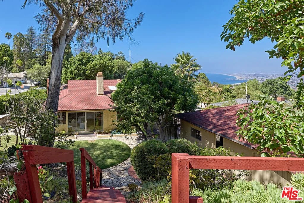
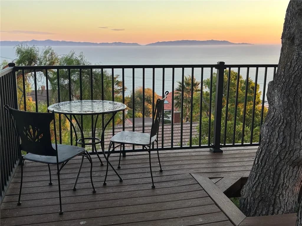
On foliage, no owner may let it significantly impair a neighbor's view by growing above 16 feet or the ridge line of the house, whichever is lower, unless a permit sets another height. A neighbor within 1,000 feet can seek a View Restoration Permit from the Planning Commission after a City-run mediation meeting. If it is granted, the applicant pays for the first trimming and the foliage owner pays to maintain it afterward. The protected view includes far views such as the ocean, the harbor, city lights and the offshore islands, and near views such as a valley or ravine; it does not include the sky or developable vacant land.
Two consequences matter in a purchase. The City issues no building permit or other entitlement to build a structure or add living area until foliage on the lot above 16 feet or the ridge line, whichever is lower, that significantly impairs a neighbor's view is removed, subject to a privacy exception. And a separate Neighborhood Compatibility review applies to new houses, to additions of more than 750 square feet or 25 percent, to remodels that demolish half of a house and to larger second-story decks, with notice to owners within 500 feet. It looks at the scale of surrounding homes, architectural style and materials, and setbacks.
Two school districts, and schools assigned by address
A Rancho Palos Verdes address does not settle the school. The state's district boundary layer puts most of the city in Palos Verdes Peninsula Unified and 16 of 163 evenly spaced sample points in Los Angeles Unified: 14 on the Eastview side along Western Avenue and 2 at the south-east coastal corner, where the nearest street addresses tested as outside Los Angeles Unified in that district's own tool.
In the Peninsula district, elementary and intermediate schools are assigned by home address. In a sample of about 140 city addresses run through the district's School Locator, eight elementary schools came back. Five are in the city: Point Vicente, Vista Grande, Mira Catalina, Soleado and Silver Spur. Three are not: Montemalaga is in Palos Verdes Estates, and Dapplegray and Rancho Vista are in Rolling Hills Estates. All three intermediate schools were returned, Miraleste and Ridgecrest in the city and Palos Verdes Intermediate in Palos Verdes Estates, and the elementary and intermediate lines do not coincide: addresses assigned to Point Vicente Elementary were split among all three, and four of them came back as a choice between Palos Verdes and Ridgecrest intermediate schools. The district says an elementary assignment is determined only after enrollment is complete, and that a student may be placed at the closest school with space when the school of residence is impacted. High school is a choice, since residents may attend either Palos Verdes High or Palos Verdes Peninsula High. Cornerstone at Pedregal, an elementary school in the city, enrolls by lottery and has no attendance area.
Eastview is different by statute. Senate Bill 1681 of 1998 made it an optional attendance area beginning with the 1999-2000 school year: parents elect either district when a child enters elementary school and again at middle school, and parents who newly move in elect when they first enroll. Every Eastview address sampled in the Peninsula locator returned Dapplegray Elementary and Miraleste Intermediate. Los Angeles Unified's own identifier assigned the same streets to Park Western Place or Taper Avenue elementary schools, both in San Pedro, then to Dodson Middle School, which is inside Rancho Palos Verdes, and San Pedro Senior High, and for 14 of the 15 addresses it lists guaranteed placement at Crestwood Street STEAM Magnet, also in the city, with a Choices application. The Peninsula district adds that Eastview homes do not pay its 2003 parcel tax and are not eligible for some of its transfer permits.
These are samples, not boundaries, and both districts revise them. Run the specific address through both tools.
Fire hazard zones after the 2025 map
Documents written before 2025 describe a different fire map, so check the date on anything that mentions one. The Housing Element the City adopted in 2024 says the 2008 state map classified the entire city as a Very High Fire Hazard Severity Zone, except the portion east of Western Avenue. CAL FIRE published new recommended zones for Local Responsibility Areas on March 24, 2025. The City Council designated Very High, High and Moderate zones by Ordinance 691 on July 1, 2025, and the City says it approved the state's recommendation with no changes, effective January 1, 2026.
The new map is not citywide. An even grid of 163 points inside the city limits, all of them Local Responsibility Area, put 57 in Very High, 9 in High and 10 in Moderate, with the other 87 outside any zone. All 14 sampled points on the Eastview side fell outside any zone. The class therefore has to be read for the parcel in CAL FIRE's viewer and cannot be inferred from the city's name or from an older report.
The zone changes both a sale and a project. Civil Code section 1102.19's documentation and written-agreement duties apply only where a local ordinance requires compliance documentation or, where none does, a state, local or qualified nonprofit entity provides compliance inspections for the jurisdiction. If the seller has not obtained the documentation, the parties use the statute's written-agreement process; without a local ordinance, the buyer's one-year deadline also depends on an eligible inspection being available. For a home built before January 1, 2010, section 1102.6f has the seller give a notice about fire hardening. In the city's own code, an accessory dwelling unit on a lot in a Very High zone must include the building code's wildland-urban interface measures, and detached units built there under the state's two-unit law must keep ten feet of separation.
Why the city exists, and who provides its services
Rancho Palos Verdes incorporated to control its coastline. In December 1969 Los Angeles County adopted a master plan for the unincorporated Peninsula, known as the Bevash Plan, that allowed high-density uses including high-rise development of up to 73 units per acre along the coast. A group called Save Our Coastline formed in April 1970 to pursue incorporation, won a court ruling that an election could not be decided by assessed land value, and got the process through the Board of Supervisors on a 3 to 2 vote. On August 28, 1973, about 80 percent of registered voters turned out and approved cityhood by a margin of 5 to 1. The City dates its incorporation to September 7, 1973. Eastview, left out at the time, petitioned to join in 1978 and officially became part of the city on January 5, 1983.
It was founded as a contract city and still is one. Law enforcement comes from the Los Angeles County Sheriff's Lomita Station under a regional contract with Rolling Hills and Rolling Hills Estates that dates from 1981. Fire, paramedic and lifeguard service comes from Los Angeles County Fire Department Battalion 14, which has two stations in the city, Station 53 on Palos Verdes Drive South and Station 83 at Miraleste Plaza. California Water Service supplies water, Southern California Edison and Southern California Gas supply energy, and EDCO holds the residential trash franchise. The City owns about 150 miles of sewer mains that the County maintains, while each property's lateral is the owner's responsibility, including the part under the street. The Palos Verdes Library District is a separate special district, and its Miraleste branch is the only one inside the city.
The City's 2026-27 budget says it receives about six cents of every dollar of basic property tax collected in the city. It levies a 3 percent utility users tax on electricity, gas and water, which the code caps at that rate without a vote of the people, and separate taxes on hotel stays and golf fees. The five council members are elected at large in November of even-numbered years.